A pause at altitude
Eating at height sharpens every taste. Crisp mountain air, fragrant wild thyme, and endless horizons give simple sustenance an unforgettable presence—provided you choose spots that do not leave you shivering in gale-force winds.
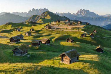
Compaccio Meadows, Alpe di Siusi (Seiser Alm)
Rolling across 52 square kilometers at roughly 1,800 to 2,000 meters altitude, the Alpe di Siusi is gentle and expansive. From Compaccio, a short 15-minute ramble along wide farm lanes leads to quiet rolling hollows carpeted with arnica and gentian flowers. The dramatic vertical towers of the Langkofel and Plattkofel stand proudly in the background.
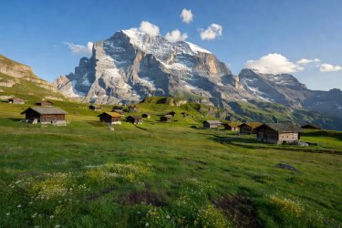
Bort Pastures & Schreckfeld Foothills
Rather than riding all the way to the crowded tourist summit of Grindelwald First, disembark at the intermediate Bort station. Here, broad flower-filled cattle pastures offer wide grassy shelves protected from prevailing valley winds by old timber hay chalets. Cowbells ring softly across the valley while the glaciated peak of the Wetterhorn towers right before you.
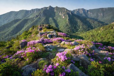
Craggy Gardens Picnic Gap
Perched high along the Blue Ridge Parkway at Milepost 364, Craggy Gardens offers cool mountain relief during humid southern summers. Ancient hardwood forests give way to natural heath balds where Catawba rhododendron bursts into purple blossom in June. The historic stone tables built by the Civilian Conservation Corps in the 1930s offer wind protection and breathtaking westward valley vistas.
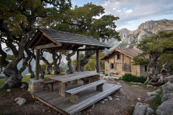
Chalet Reynard Woods, Mont Ventoux
The bald limestone summit of the "Giant of Provence" is notoriously scorched by sun and lashed by the Mistral wind. However, six kilometers below the summit, the ancient beech and larch woods surrounding Chalet Reynard provide dappled shelter, cool fragrant air, and dramatic views over the Luberon valley without the buffeting wind.
Alpine Safety & Comfort Checklist
Planning an elevated picnic requires adjusting your expectations regarding weather and temperature. What feels warm and calm in the valley can turn blustery and damp within minutes at altitude.
| Factor | Valley Condition | Mountain Reality (1,500m+) | Sensible Preparation |
|---|---|---|---|
| Temperature | 24°C (T-shirt warmth) | 14°C with windchill feel of 10°C | Pack a windproof outer layer, woolen socks, and an insulated flask. |
| Ultraviolet Sun | Moderate UV index | High UV index (+10% per 1,000m) | Wear a broad-brimmed hat; do not rely solely on light shade. |
| Ground Moisture | Visibly dry grass | Dense spongy turf retaining morning dew | Carry a waterproof tarpaulin or sit on fallen logs/dry limestone. |
| Afternoon Weather | Steady overcast or clear | Rapid convective cloud buildup & thunder | Eat before 13:30; retreat to shelters if skies darken suddenly. |